PHOTOGRAMMETRY
Photogrammetry Services
AERIAL MAPPING
High-resolution aerial maps for site planning, spatial analysis, and precise measurements, delivered quickly and cost-effectively.
3D TERRAIN MODELLING
Create accurate 3D models of landscapes for earthworks, slope analysis, and detailed topographic visualization
VOLUMETRIC MEASUREMENTS
Accurately calculate stockpile volumes, excavation quantities, or material usage with aerial photogrammetry data.
3D TEXTURED MODELS
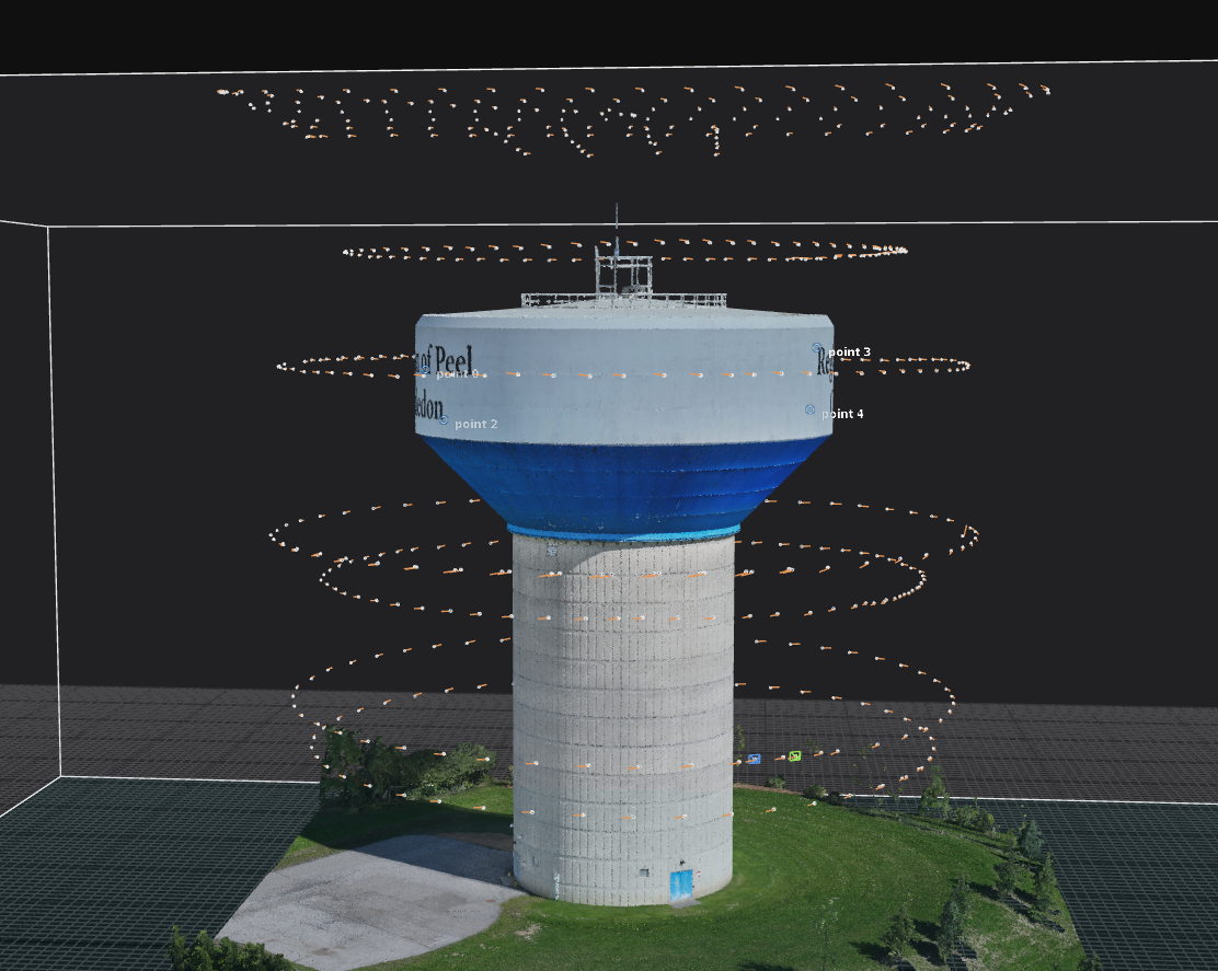
Create detailed 3D models of structures for inspections, construction progress tracking, and project visualization
AGRICULTURE MAPPING (NDVI)
Analyze crop health, monitor vegetation, and optimize yields using NDVI and multispectral aerial mapping.
2D / 3D THERMOGRAPHY
Detect heat loss, moisture intrusion, and structural issues with thermal orthomosaics and 3D thermographic models
How We Work
Our process begins with understanding and engaging deeply with our clients' goals and project requirements. We immerse ourselves in the unique context of each site, uncovering opportunities that lie within the landscape or structure. This hands-on approach, which we call “exploring the site,” allows us to align our methods with the specific environment, ensuring each project reflects its inherent potential.
Every project we undertake is part of a larger system – whether it’s contributing to safer infrastructure, better environmental stewardship, or more efficient workflows. We strive to deliver results that not only meet immediate objectives but also align with a more sustainable and forward-thinking vision.
Collaboration is at the heart of our work. Together with our clients and industry partners, we identify and nurture opportunities for positive change. Our team of skilled drone pilots, photogrammetry specialists, and data analysts guide projects through every stage – from initial planning and data capture to advanced processing and actionable insights.
We also work closely with a network of expert consultants, ensuring our solutions are precise, innovative, and of the highest quality. Whether it’s mapping complex terrain, creating detailed 3D models, or providing tailored deliverables, our goal is to elevate every project we touch.

Photogrammetry Process & Deliverables
Consultation & Planning
Discuss project goals and requirements.
Data Capture
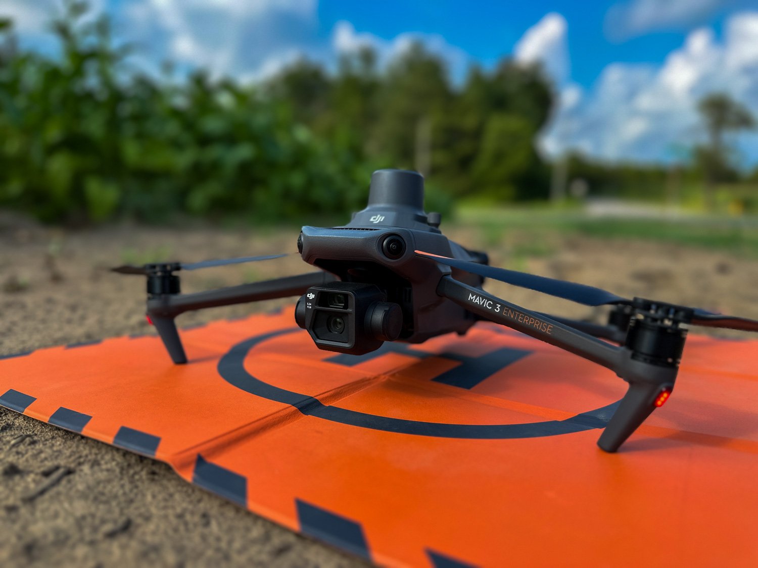
Efficient aerial or ground-based data collection
Process & Analysis
Using advanced software for precise results.
Delivery & Support
Final Deliverables and ongoing assistance
Orthomosaics
Seamless, high-resolution aerial images georeferenced for GIS applications.
Digital Elevation Models (DEMs)
Bare-earth elevation models for topographical analysis.
Contour Maps
Customizable contour intervals for land-use planning and engineering.
Volumetric Reports
Detailed measurements of stockpile volumes with reports for asset management.
Digital Surface Models (DSMs)
Elevation data that includes vegetation, buildings, and other above-ground features.
Point Clouds
Dense 3D point clouds for detailed spatial data visualization and analysis.
3D Models
Realistic and interactive 3D representations for presentations, VR/AR integration, or project visualization.
GIS & CAD Integration Files
Deliverables in formats compatible with GIS (e.g., .shp, .geojson) and CAD (e.g., .dwg, .dxf) platforms.
Spotlight Service
3D Roof Models for Inspection and Measurement
A commercial roofing consultant came to us with a challenge – to find a safe and detailed way to inspect a large hotel roof that had a bvery steep pitch. Inspecting on foot with regular cameras and tape measure would have been very costly and risky. Our solution was to use our drones, equipped with wide and zoom lenses, to captured RGB imagery from multiple angles over the entire roof. In addition to single images, we ran multiple mapping missions with overlapping images, to create a high resolution 3D photogrammetric point cloud and mesh model with textures.
The result? An accurate interactive 3D model with centimeter level accuracy, that allowed the client to inspect and measure every part of the roof without stepping foot on the steep surface. Time and risk saving!
Click the interactive 3D model below:
Related Articles & Guides
Understanding Photogrammetry:
A Guide to Its Applications and Benefits
Does Splitting and Merging Pix4D Matic Projects Speed Up Processing Times?
FAQ’s
Q: What is an Orthophoto in Photogrammetry?
A: An orthophoto (also known as an orthomosaic) is a high-resolution aerial image that has been geometrically corrected to ensure a consistent scale, just like a traditional map. Unlike a regular photo, an orthophoto accurately represents the Earth's surface, allowing for precise measurements of distances, areas, and angles.
Through advanced photogrammetry techniques, multiple overlapping images captured by drones or aircraft are stitched together and corrected for camera tilt, lens distortion, and terrain elevation. This correction process ensures that every point in the image has a true geographic coordinate.
Orthophotos are commonly used for:
Drone surveying
Construction site monitoring
Agricultural analysis (e.g., crop health)
Environmental and urban planning
Real estate and asset management
In short: A normal aerial photo shows what the camera sees; an orthophoto shows a true-to-scale map made from real imagery.
Q: What is Photogrammetry in Remote Sensing?
A: Photogrammetry in remote sensing is the science of using photographs — usually taken by drones, airplanes, or satellites — to measure and map the Earth's surface.
It involves capturing overlapping images from different angles and then using specialized software to create accurate 3D models, maps, and measurements.
In remote sensing, photogrammetry helps turn raw images into valuable data, such as:
Elevation models (3D maps of terrain)
Orthophotos (corrected aerial images for measurement)
Volume calculations (like stockpiles, earthworks)
Detailed site surveys without setting foot on the ground
In short: Photogrammetry is how we turn drone or satellite images into powerful tools for planning, surveying, and analysis — all without needing direct contact with the site.


